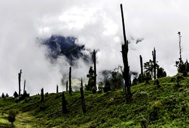
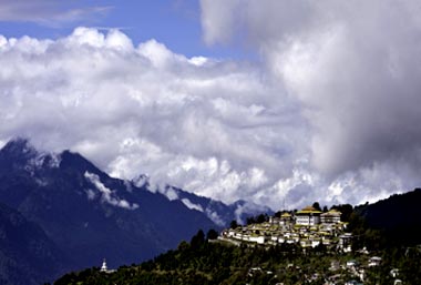
Arunachal Pradesh is India’s easternmost state, bordering Burma in the east, Bhutan in the west and China in the north. The largest of the north-eastern states, this “Land of the Dawn-lit Mountains” is probably India’s last wilderness, one that’s still (mercifully) unspoiled. Arunachal is blessed with secluded monastery hamlets, an astonishing variety of orchids (500 species) and, in the valleys, a wonderful mix of tribes, their cultures and livelihoods still intact.
The area, isolated since 1873 when the British stopped free movement, was recently opened to tourists by the government albeit in a restricted manner. Rafting and kayaking its numerous rivers, mainly towards the east of Arunachal, is the best way to explore this inaccessible, culturally rich but ecologically sensitive region. The small towns of Along and Pasighat – capitals of West and East Siang districts, respectively – are good bases for rafting and angling trips, and also for rafting excursions.
History
With Tibet to its north, Arunachal has forever been a sensitive region for the Indian authorities. China has always claimed it as its own, and the state’s fraught existence was brought home graphically in the 1964 Indo-China War, when Chinese troops entered 300km into Indian territory, through Arunachal and into Assam. Since then, India has, over the years, markedly strengthened its north-eastern border. Everyone visiting Arunachal requires a permit to enter the state.
Geography
Arunachal Pradesh has a fascinating diversity of habitats within its borders, thanks to a range of elevations – from river valleys and subtropical rainforests lower down to verdant wooded ridges in the middle and higher reaches, and alpine pastures and snow-topped peaks in the uplands. This remote state gets even more remote the further west you go, the valleys and hills ascending to glaciers and little-known peaks extending to beyond 20,000ft (approx. 6000m); only Gori Chen (21286ft, 6488m) and Nyegi Kangsang (23120ft, 7047m), both a small distance away from Bomdila, have been attempted.
Weather
The climate here depends on the altitude. In the Upper Himalayas, towards the border with Tibet, winters are desperately cold. In the middle reaches of the Himalayas, you’ll find a temperate climate, while lower down, hot summers and mild winters are the norm.
How to reach
Buses (state and private) connect Itanagar, the state capital, to Guwahati, Assam (10-11hrs), and towns across Arunachal.
The nearest airport is in Assam, at Lilabari (near North Lakhimpur), 67km from Itanagar.
Getting Around
From Itanagar, Sumos run to Along (10hrs), Bomdila (7-8hrs), Pasighat (6-7hrs) and Hapoli (5hrs). Sumos (and buses) also run from Tawang to Bomdila and Dirang.


 Share Via


