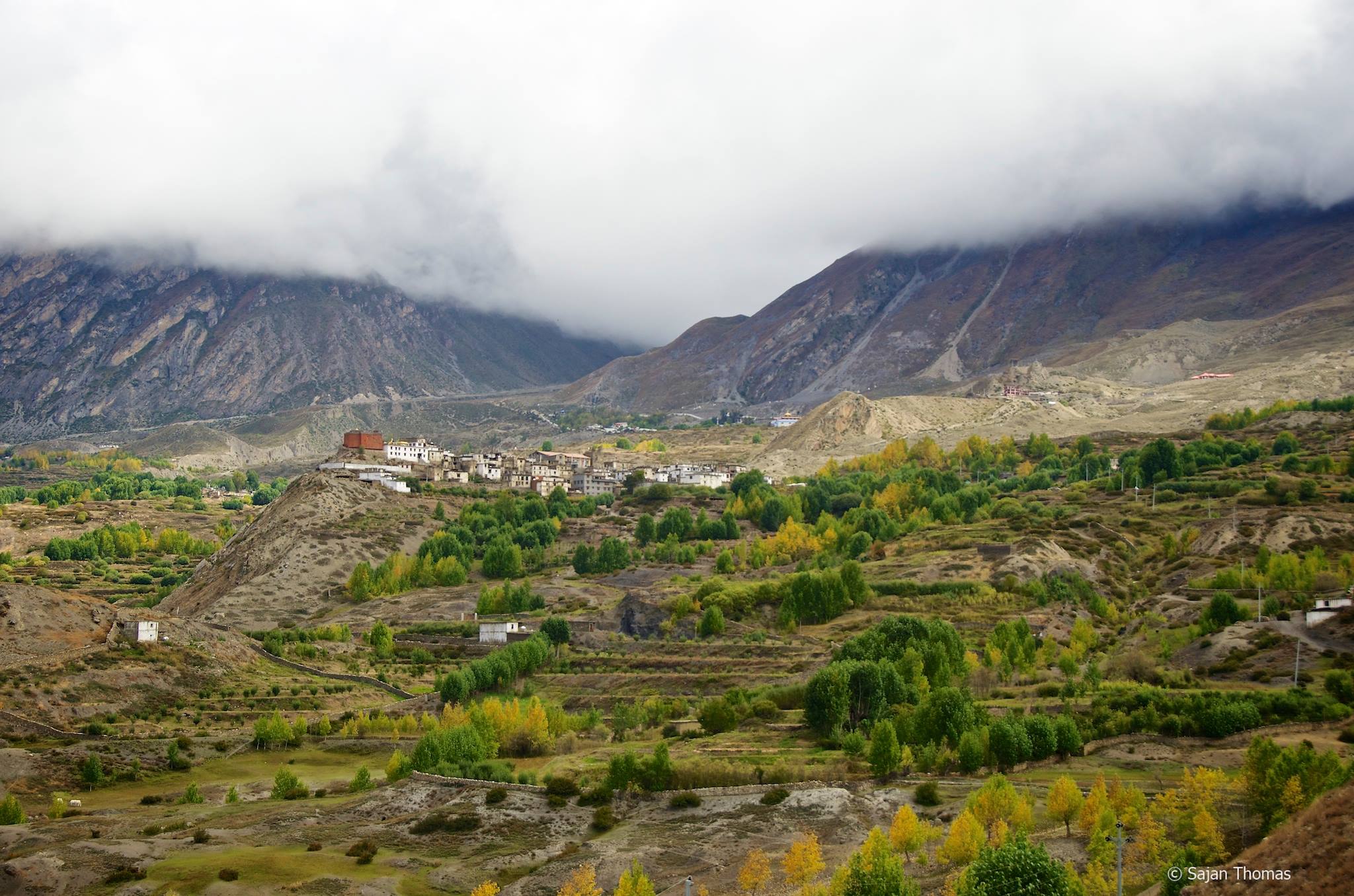
The Mustang Valley consists of Lower Mustang and Upper Mustang, which was once the formed kingdom of Lo. It is an isolated and remote region in the Nepalese Himalayas. Ethnically, the people of Mustang are Tibetans, and most of them live along the banks of the Kali Gandaki River. Life, especially in Upper Mustang, revolves around tourism, trade and animal husbandry.
Upper Mustang, the capital of which is Lo Manthang, consists of the northern two-third region of the district of Mustang. It is home to the Loba people, and even though politically it is a part of Nepal, its culture is based on traditional Tibetan lifestyle. The walled city of Lo Manthang is considered by many as the finest preserved medieval fortress in the world. The southern, third part of the Mustang district is known as Thak and is home to the Thakali people, whose culture is an amalgamation of Nepalese and Tibetan elements.
Since the region is untouched by modern civilisation, the Tibetan way of life that persists here is something that has disappeared even in Tibet. Tibet, which came under the rule of Chinese in 1950, witnessed the severe destruction of their monasteries; however, this has not been the case in Mustang. It is still home to several monasteries that have been preserved by the locals.
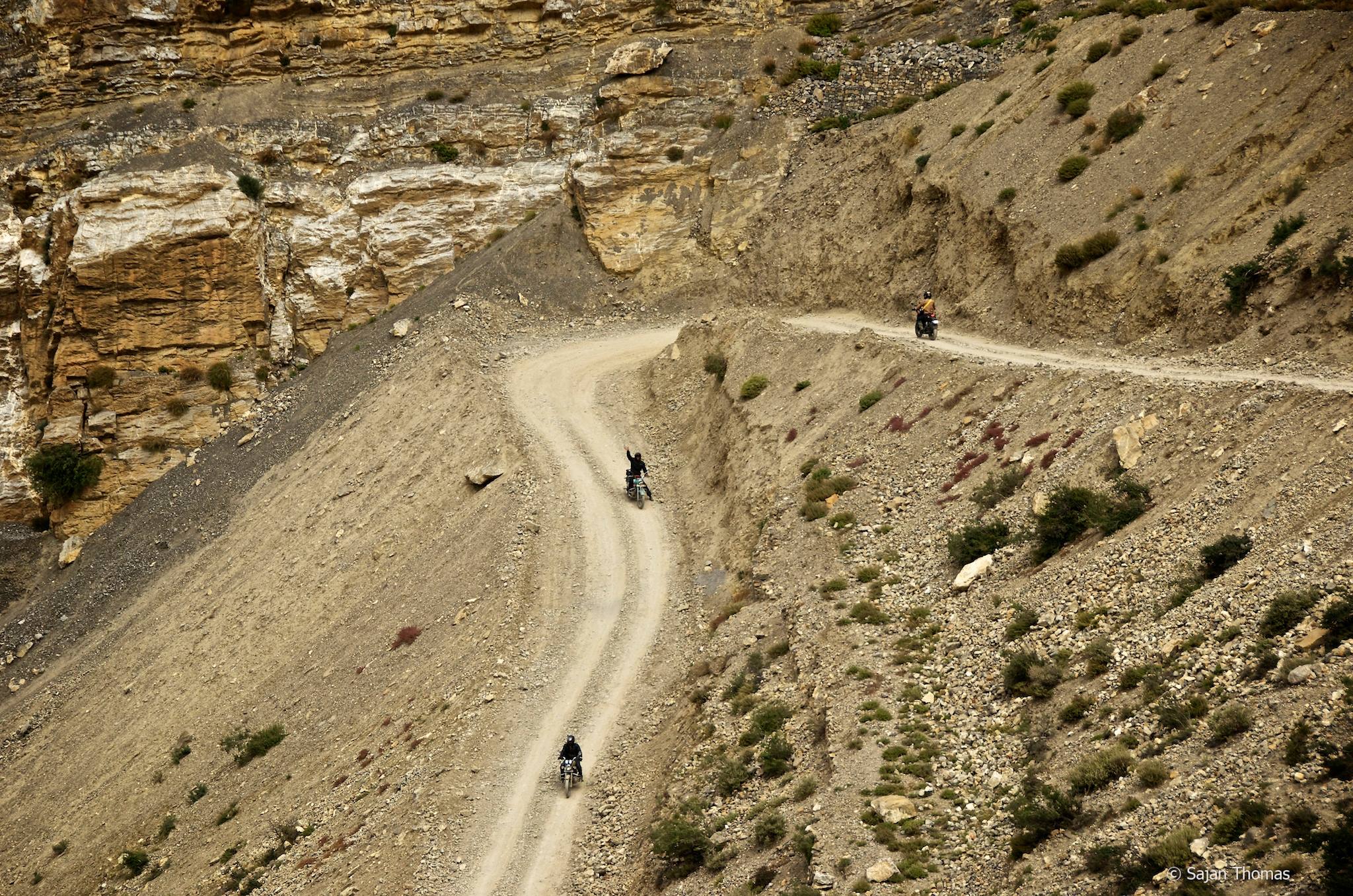
Upper Mustang is still a restricted region and to get access to this area, one is required to obtain a special permit from the concerned authorities. Since 1992, when it was officially opened for a few trekkers, the region of Upper Mustang along with the Annapurna Circuit in Lower Mustang has gained huge popularity among adventurers from across the globe. There are several trekking, cycling and motor biking opportunities in this region, but it is only for those who can sustain themselves in the difficult weather and terrains of the Himalayas. Besides trekking, the Mustang Valley is famous for its springs and Muktinath village, which is a revered Buddhist and Hindu pilgrimage site. Furthermore, spending time at Jomsom and Lo Manthang to witness the locals and their lifestyle is something that most trekkers to this region look forward to.
Another interesting thing to explore in this region is the collection of cave paintings, 55 in number, that depict the life of Lord Buddha. These 12th century paintings were found in a cave, which is partly collapsed. In terms of festivity, the Upper Mustang has gained reputation of holding one of the major annual festivals in the region, and it is called the Tiji Festival. This three-day event is held to celebrate the victory of Lord Buddha’s incarnation. During this event, the monks perform traditional dance forms – Tsa Chham on the first day and Nga Chham on the second day.
History
Towards the beginning of the 8th century, the region of Lo along with the close by region of Dolpho came under the Tibetan Empire. A couple of centuries later, both the regions were incorporated into the Purang Kingdom, which was then ruling the western part of Tibet. During the mid-10th century, the region of Lo was conquered by the newly-formed northern kingdom of Gungthang. A few centuries later, the western part of Tibet saw the emergence of the Jumia Kingdom, which in the early part of the 14th century overthrew the Gungthangs to conquer Lo.
The latter part of the 14th century saw the establishment of the Lo Empire under King Ame Pal. According to legends, Ame Pal was the direct descendant of the Gungthang lineage. Under him, the Lo Empire prospered for the next few centuries, especially in its commercial activities. In the 18th century, the Gorkha kings conquered the Kathmandu Valley as well as the Lo kingdom, which from thereon, went onto become a part of Nepal.
Lo was considerably affected after the People’s Republic of China gained access to Tibet in 1950. As a result, its political stability dwindled, and with it began the closing of all its borders. Slowly, it became isolated from the rest of the world. Though closed, the Nepal Government did allow some researchers into the Mustang area, from time-to-time on request. However, this changed when the government allowed the first legal trekking expedition into the Mustang region in March 1992. Officially, the kingdom of Mustang ended in 2008 with Nepal becoming a republic. Its last king, Jigme Palbar Bista, might have stepped down as the king of Mustang, but he still is looked up to by the local population.
Geography
Mustang is among the 75 districts of Nepal, with Jomsom being its headquarters. It covers a land area of more than 3573 sq km and is surrounded by high mountains, namely Dhaulagiri and Annapurna. The most important geographical feature in this region is the Kali Gandaki River, which flows towards Nepal Terai dividing Mustang. Some of the routes that lie parallel to this river had once served as major trade routes between India and Tibet. A part of this river valley in the southern part of the district forms one of the deepest gorges in the world. While the arid land of Upper Mustang makes agriculture a difficult task, the lower part of the district has moist land, making it favourable for vegetation.
Weather
The Upper Mustang area experiences a trans-Himalayan climate, which is typically semi-arid and cool. It receives rainfall in the range of 250 to 400 mm. Since it is surrounded by the Dhaulagiri and Annapurna mountain ranges, it receives less rainfall than the rest of Nepal. Trekking is one adventure activity that attracts many thrill seekers to Upper Mustang. The best time to go on a trekking expedition in this region is October to November. While those interested in climbing and crossing high passes should plan coming here during the months of April and May. Cycling and motor bike rides are also gaining popularity in this valley.
How to reach
To reach Upper Mustang, the best way is to fly to Jomsom from Pokhara. The best part about the flight from Pokhara to Jomsom is the opportunity to witness the fantastic deep gorge formed by the Kali Gandaki River. From Jomsom, one has to trek following the river upstream till the village of Kagbeni. To trek beyond this point, one needs a special Mustang permit. From Kagbeni, the trail heads to the town of Tangbe, followed by the village of Chele. The next two destinations on the trekking expedition to Upper Mustang are Geiling and Charang. From Charang, the trek heads to the capital of Upper Mustang – the beautiful walled city of Lo Manthang.
Getting Around
To explore this region, one has to take up hiking and trekking, or cycling, motor biking, and that too under the guidance of experts. Interesting to note is that only a limited number of adventure groups are allowed in the Upper Mustang region, and getting prior permissions for that is an absolute mandate.


 Share Via


_1438594349_gUf5yi.jpg)