The beautiful kingdom of Bhutan is a landlocked nation, located towards the eastern end of the mighty Himalayan Mountain Range in South Asia. Known as the Last Shangrila, its official religion is the Vajrayana form of Buddhism. The country is rich in flora and fauna, which can be witnessed at its various national parks and wildlife sanctuaries; the famous ones being Jigme Dorji National Park, Thrumshingla National Park and Royal Manas National Park.
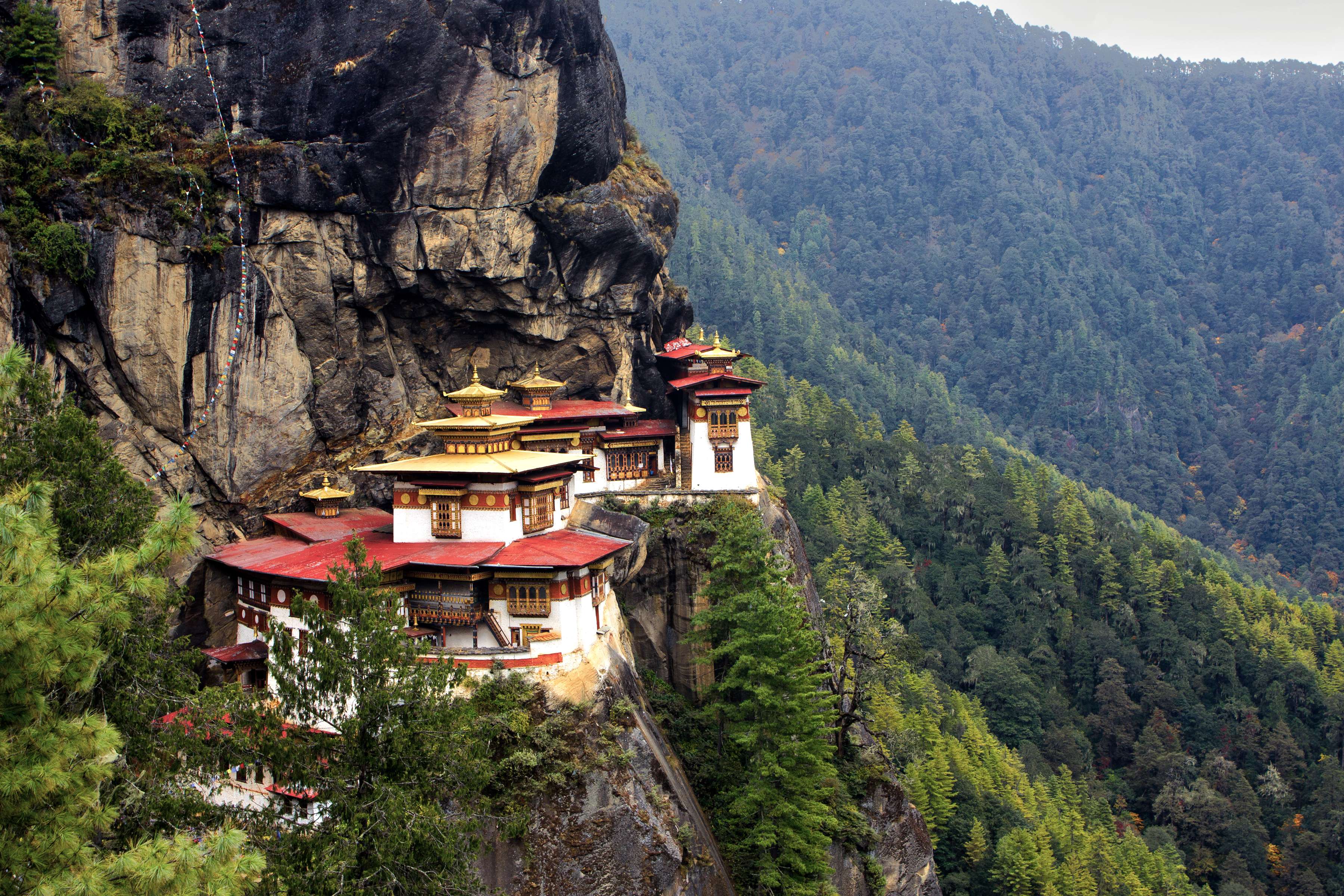
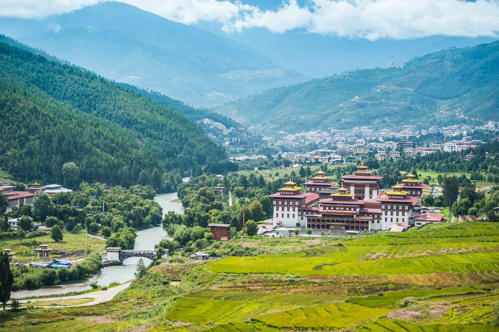
Besides natural wonders, Bhutan is also famous for its historic dzongs and monasteries. The dzongs are ancient fortresses that today serve as the headquarters of civic and monastic administration. Some of the top dzongs in the country are Punakha Dzong and Drukgyel Dzong. One of the top monasteries to visit in Bhutan is Taktsang Monastery, which has been built atop a 1200 m cliff. Another important religious site to visit in the country is Kurje Lhakhang, where Guru Rinpoche is believed to have practiced meditation. Bhutan as a nation gives a lot of importance to its culture. This aspect of it can be witnessed in its religious festivals called Tshechu, which are held in monasteries, temples and dzongs across the nation. Some of the most popular festivals that are worth witnessing here are Takin Festival, Punakha Tshechu and Drubchen, Paro Tshechu and Druk Wangyel Festival.
Besides festivals, what draw thousands of tourists to this small Asian kingdom are the adventure opportunities. Trekking in the mountainous regions of Bhutan is a top favourite among thrill seekers, followed by rock climbing, cycling, rafting and kayaking. Bike rides and road trips to Bhutan have gained immense popularity over the years. Another wonderful aspect of this nation is its spicy cuisine. Rice is an integral part of the Bhutanese cuisine, with meat and vegetable dishes accompanying it. To enjoy a delicious serving of the local cuisine, one must consider tasting Ema Datish, Jasha Maroo, Goep and Red Rice.
History
Archaeological discoveries hint that Bhutan was inhabited as early as 2000 BC. Originally, it was known by various names, including Lho Jong Men Jong, Lho Jong, Lho Mon Tsenden Jong and Lho Mon Kha Shi. However, during the 17th century, it came to be called as Druk Yul. This name is in reference to the Drukpa sect of Buddhism, which has been the major religion in the country since the 17th century. Prior to that Bonism was the main religion. The introduction of Buddhism in Bhutan happened in the 7th century, and it was through the Tibetan king, Songtsen Gampo. With the arrival of Guru Rinpoche in the country, Buddhism strengthened its position.
One of the most important events of Bhutan’s history came in the 17th century, when it was first unified by Zhabdrung Ngawang Namgyal. He was influential in introducing a comprehensive system of governance and law in the country; however, this changed after his death, with the nation reeling under the affects of civil war between local rulers. The scenario remained unchanged until the arrival of Trongsa Penlop Ugyen Wangchuck, who with the support of people became the nation’s first hereditary king in the year 1907. Bhutan passed its constitution in 2008 and established its democratic set up with the aim of safeguarding the rights of its citizens. In the same year, the current king, Jigme Khesar Namgyel Wangchuck was crowned.
Geography
The landlocked nation of Bhutan shares its borders with the Indian states of Assam, Sikkim, Arunachal Pradesh and West Bengal as well as the Tibet Autonomous Region. Its landscape mostly comprises high and steep mountains, along which flow a network of rivers that eventually drain into the plains of India. Elevation in the country ranges from 200 m to more than 7000 m. Owing to this difference in altitudes combined with other climatic conditions, the country has been blessed with varied biodiversity and ecosystems. The highest mountain peak in the country is Gangkhar Puensum, which has an elevation of approximately 7570 m. It is said to hold the distinction of being the world’s highest unclimbed mountain. This peak lies in the northern region of Bhutan. Another extremely difficult trek in the region is the Snowman Trek, taking close to a month to complete.
In its central region lie the Black Mountains, which form a divide between two major river systems, namely Drangme Chhu and Mo Chhu. In the Black Mountains range, peaks range between 1500 m and 4925 m above sea level. The lower elevations in the central part of Bhutan consist of Eastern Himalayan broadleaf forests while the higher elevations comprise Eastern Himalayan subalpine conifer forests. Some of the rivers that drain this central region are Manas, Sankosh, Torsa and Raidak. In the southern part of the country lie the Shivalik Hills, featuring alluvial lowland river valleys, dense Himalayan subtropical broadleaf forests and mountains with a height up to 1500 m above sea level.
Weather
The kingdom of Bhutan has an extremely varied climate owing to its different geographical altitudes and the influence of what is known as the Indian monsoons. Its southern part experiences a sub-tropical hot and humid climate almost throughout the year, with temperatures ranging between 15 and 30 degree Celsius. The central regions of the country, on the other hand, experience cool, dry winters and warm summers. The several mountain peaks in the nation are always covered in snow, while the lower parts remain cool even in summers because of the high altitude.
The spring season in Bhutan starts in early March and continues till mid-April. It is followed by the summer season with occasional showers until late June. Thereafter, sets in the Indian summer monsoon, which continues till late-September. However, it remains mostly confined to the southern border region of the nation. Heavy rains coupled with high humidity become a common occurrence during these months. The Indian summer monsoon is also responsible for about 60 to 90 per cent rainfall in the western regions of Bhutan.
The rainy season is followed by autumn, which continues through late-September until late-November. This period is characterised by sunny days and early snowfall at higher altitudes. The winter sets in from late-November and continues till March, with snowfall being common at elevations above 3000 m.
How to reach
Up until early 1960s, Bhutan remained isolated from the rest of the world. It was difficult to enter its land as it was only accessible by foot with one entry point each in the north and the south. The route from the north required one to come through Tibet, crossing difficult mountain passes that became inaccessible in winters. The route from the southern direction required one to enter Bhutan through the plains of West Bengal and Assam, passing dense forests.
After 1960, the scenario has changed with the country now being accessible through a network of roads as well as one international airport – Paro International Airport. From the south, the main road entering the nation is through Phuentsholing, which connects it with the Indian state of West Bengal. From the east, another road enters through Samdrup Jongkhar, which links it to the Indian state of Assam, while from the central region another road enters through the border town of Gelephu.
All visitors coming to this country require an entry visa; clearance of which is required to be done before coming here. Also, the travel needs to be booked by a Bhutanese tour operator or its international partner. Those coming from India, Maldives and Bangladesh can get a visa on entry and need not book their travel through any tour operator; however, it is recommended to do so. For Indian nationals, their voter ID card or passport is acceptable for entry.
Getting Around
To travel within this nation, one requires route permits that need to be produced at check posts in most districts that lie towards the east and north of the national capital, Thimphu. These permits are processed by local tour operators once one applies for the Bhutan visa through them. Once approved, these permits can be obtained from immigration office at the national capital.
Within Bhutan, one can avail the inter-district or local bus services to travel. However, the best option is to ask the local tour operators to arrange for a vehicle and a driver for the duration of the entire trip. Those interested to self-drive in Bhutan should be aware of the fact that most part of the country features mountainous terrains. The quality of road surface varies from region to region, with endless hairpin bends along the way. Another common way of getting around the country is through hitch-hiking since the public transport service between different regions is quite infrequent. Generally, it is safe to hitchhike across the country, especially outside most urban areas.
Since most of the terrain in the country is mountainous, roads get blocked by rock falls, especially during the summer season. Hence, it is advised not to travel long distances between the months of June and August. However, if one does travel during these months, it is advised to carry sufficient snacks and bottled water in case a landslide happens and clearing the road takes time. Those travelling to Thrumshingla Pass (approximately 3750 m) should bear in mind that this valley has steep sides and rock falls are a common occurrence; hence, long waits are inevitable.


 Share Via


_1438692796_K0LPS3.jpg)