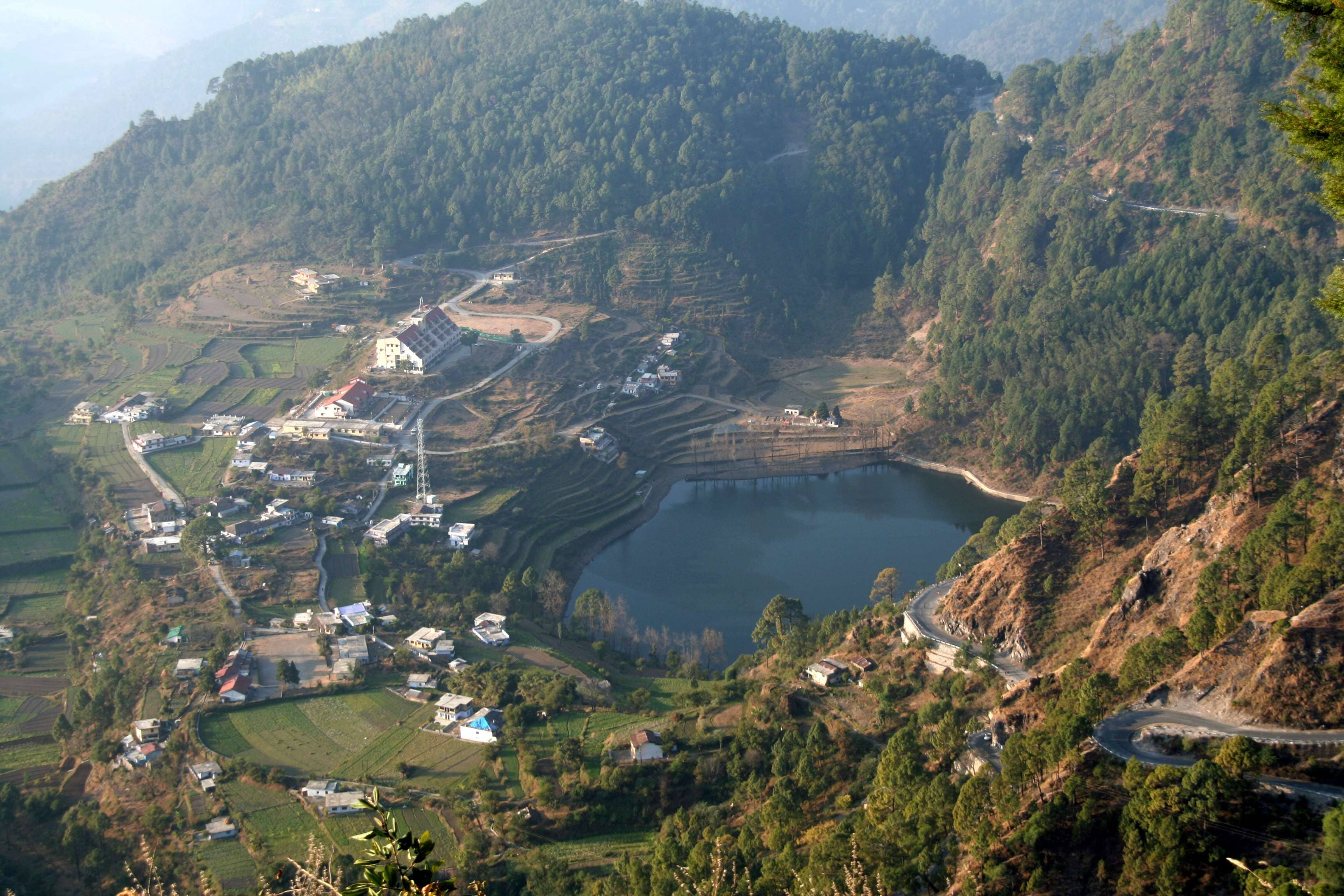
One of the two regions and administrative divisions of the North Indian state of Uttarakhand, Kumaon is set in the Himalayas. Six districts of the state that lie in this division include Nainital, Almora, Champawat, Bageshwar, Pithoragarh, and Udham Singh Nagar. Nainital is the administrative headquarters of the division, and important towns within the region include Haldwani, Almora, Nainital, Pithoragarh, Kashipur, Pantnagar, Rudrapur, Mukteshwar and Ranikhet. Each town has its own relevance when it comes to tourism; most of them are renowned hill stations.
Scenic vistas of the Himalayas, pleasant mountain breeze, tall deodars and pines, along with numerous places of religious interest allure tourists. Although Kumaon witnesses travellers throughout the year due to its welcoming climate, the best time to visit the region is from March to June and from September to October.
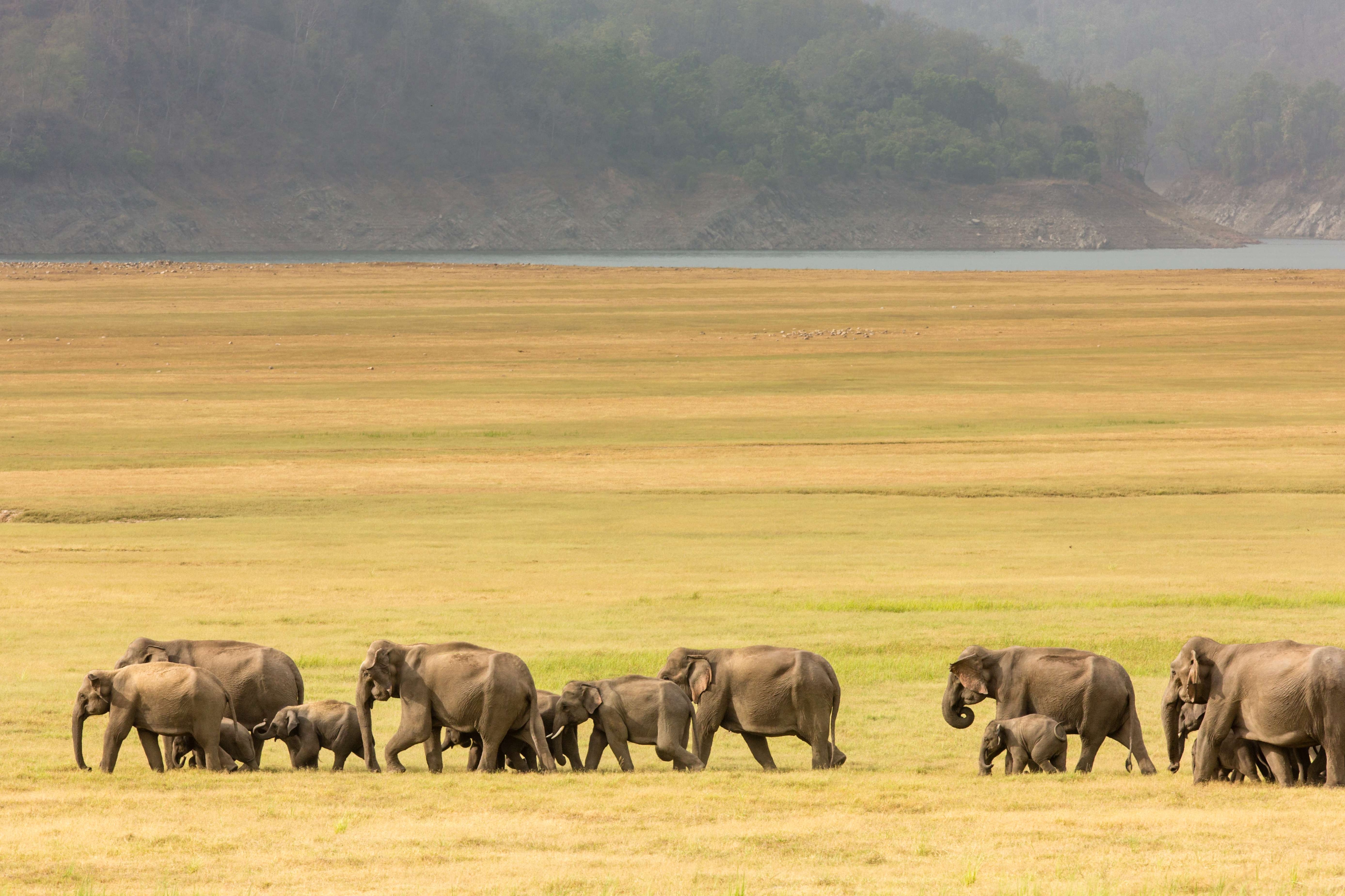
Pandit GB Pant High Altitude Zoo, Cave Garden, and birding sites like Pangot and Kilbury are a few noted attractions in Nainital. Besides, Binsar Wildlife Sanctuary and Jim Corbett National Park and Tiger Reserve are great places to observe the region’s diverse fauna, thriving in its natural environment. Boating on Naini Lake or Bhimtal Lake and trekking to Binsar, Chota Kailash, Milam Glacier, Pindari Glacier and Sunderdhunga Glacier are popular activities. Narayan Ashram and Mayawati Ashram are two spots that are known for offering a spiritual therapy. Sites like Jageshwar, Patal Bhuvaneshwar, Reetha Sahib and Nanakmatta are renowned for the religious beliefs associated with them.
With great pomp and gaiety, a number of fair and festivals are celebrated by Kumaonis, the inhabitants of the Kumaon region, round the year. The most prominent among them is Nanda Devi Fair, which is celebrated at various places in the month of September. Bagwal, Kangdali Festival and Hill Jatra Festival are other such events that signify the lively spirit of the Kumaoni people. Family gatherings like Bhitna, celebrated in the spring season; and local festivals like Kale Kauva, which falls on the day following Makar Sankranti, are also celebrated in the Kumaon region.
Another important festival of Kumaonis is Bagwali Ka Teeka, more commonly known as Bhai Dooj in India. The Kumaoni version includes a special tilak ceremony, wherein the leaves of the barley plant are kept on people’s head. Kumaoni cuisine is simple yet nutritious and includes preparations that suit the harsh mountain climate. Regional specialities include dishes like Churkani, Palio, Palak Ka Kapa, Aloo Ke Gutke, Bhatt Ke Dubke, Bhannge Waala Kaddu and Paptaule.
Mall Road, Bara Bazaar and Tibetan Market in Nainital, and Lal Bagh Market and Chowk Bazaar in Almora are noted shopping destinations in Kumaon.
History
The word Kumaon is known to have originated from Kurmanchal, which means the land of the Kurma, the tortoise incarnation of Lord Vishnu. During the British regime, the division was called Kemaon.
The history of the division dates back to the Stone Age as suggested by several archaeological excavations in the region. The paintings that were found at the rock shelters in Kumaon’s Lakhudyar region are said to be from the Mesolithic period. It is believed that the earliest settlers in the region were the Kols, who occupied it after losing a battle with the Dravidians from the southern part of the country. Later, they were accompanied by Khasas of Indo-Aryan origin.
Kunindas are believed to have ruled over the whole of north India, including Kumaon, from 500 BC to 600 BC. However, historical records of the Kunindas exist only from 2nd century BC, and they are mentioned in Indian epics like the Puranas and Mahabharata. Katyuri kings then ruled the region between 7th and 11th centuries AD. At its peak, the Katyuri Empire extended from Nepal to Afghanistan. The Katyuris are also noted for the establishment of an array of temples in the Kumaon region and were one of the first to use hew stones in their construction instead of bricks.
After their decline, the kingdom disintegrated into eight princely states, namely Baijnath Katyuri, Dwarahat and Doti (in Nepal), and Baramandal, Askot, Sira, Sora and Sui (Kali Kumaon). The Chand Dynasty came to the region in the 10th century AD and shifted Kumaon’s capital to Almora, starting the process for the displacement of the Katyuris.
The ultimate downfall of the Katyuris happened in the late 11th century, and they were later attacked by Ashok Malla and Kruchalla Dev of Doti’s Malla dynasty between AD 1191 and AD 1223. Towards the end of 17th century AD, the Chand rulers successfully invaded the Garhwal and Doti regions. However, Garhwal was later re-occupied by King Pradip Shah. During this period, Kumaon also witnessed intrusions by the Rohillas and Mughals.
The Garhwali king, Lalit Shah, and his son, Parduman Shah, are also known to have ruled Kumaon for a short period, until the arrival of Prithvi Narayan, a Gurkha king from Nepal. The Gurkhas maintained their rule in the region for about 24 years and were later defeated by British and Kumaoni troops under the command of Harak Deo Joshi. The British recognised the bravery and military expertise of Kumaonis and awarded them with the title of Martial Race. Kumaon was subsequently merged with the neighbouring Garhwal region in 1816 by the British administration and absorbed into the Empire.
Prior to the Indian Independence in 1947, Kumoanis actively took part in various movements against the British rule. Uttarakhand, where the Kumaon region falls, was carved out of the state of Uttar Pradesh and given the status of an independent state on 9th November, 2000.
Geography
Kumaon is bounded on the north by Tibet and on the south by Uttar Pradesh. On the west, it is bordered by the Garhwal region and on the east by Nepal. The Kumaon region is made up of the Himalayas and two submontane strips, known as Terai and Bhabar. Until 1850, the submontane strips were a nearly impassable dense forest, solely occupied by wildlife. After 1850, as a result of several clearings, a large number of people from the hills started cultivation in the submontane strips.
The Himalayan section of Kumaon is approximately 225 km long and 65 km wide. This tract accommodates more than 30 major peaks, with some rising as high as 5500 metres above mean sea level. Major rivers in the region, such as Goriganga, Dhauliganga, and Kali originate from the Himalayan peaks, bordering the Tibet Autonomous Region of China. The other rivers that flow through the region include Sharda, Pindari and Kaliganga, with the Sharda River separating India from Nepal.
Himalayan cypress, chir pine, pindrow fir, sal and alder are the important trees that grow in Kumaon, while the rock formations here mostly constitute sandstone, granite, limestone, slate and gneiss.
Weather
The weather in Kumaon, which experiences variations of subtropical climate, remains pleasant round the year. This happens as the hilly terrain of the region leads to changing altitude. Summer, winter and monsoon are the major seasons that exist here. April, May and June are the only months of the summer season, during which the weather is fairly mild. The average maximum temperature in summers is around 46 degree Celsius, while the lowest during the same is nearly 19 degree Celsius.
Winter lasts from October to February, and at some places it is extremely cold during this period. Snowfall also occurs in areas at high altitude. The mean maximum winter temperature is about 25 degree Celsius and the minimum is 4 degree Celsius. The region observes rain during the months of July, August and September with mild showers hitting towns and cities. Monsoon initially strikes the outer Himalayan Range, which receives almost double the amount of precipitation witnessed by the central hills. The average annual rainfall in Kumaon ranges between 1000 and 2000 mm.
How to reach
Pantnagar Airport is the main airfield serving the region. Flight service is available from Delhi to this airport. Chaudhary Charan Singh International Airport in Lucknow, Uttar Pradesh, and Indira Gandhi International Airport in Delhi are two nearest international airfields.
Kathgodam Railway Station, around 35 km from the town of Nainital, is well connected to Dehradun, Delhi, Jammu and Howrah. Other major stations in Kumaon are in Lalkuan and Haldwani.
Taxi services along with buses, both standard and luxury, ply from Delhi to various places deep in the region.
Getting Around
Haldwani, a city in the Nainital district, is regarded as the gateway to Kumaon. State-owned and private buses are available from Delhi to this city on a daily basis.
Shared and reserved taxis can be hired at the railways stations in Haldwani, Kathgodam and Lalkuan. Private operators and Uttrakhand roadways run buses that ply between various cities and towns in the region. Cycle rickshaws and auto-rickshaws are a relatively cheaper option that can be picked to conveniently explore a town or city in Kumaon.


 Share Via


_1437473532_ztsSgF.jpg)