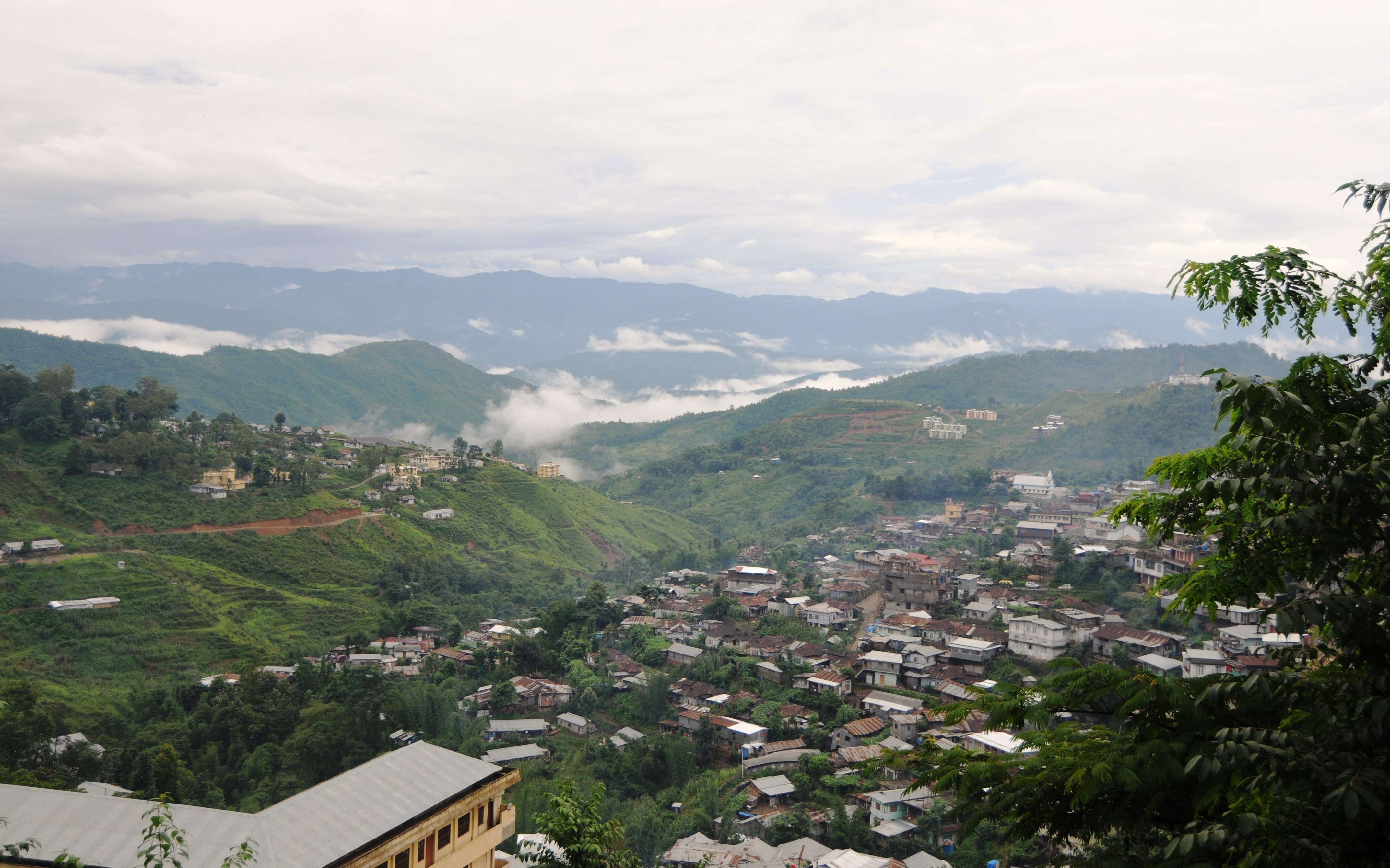
Nagaland is a state located in the extreme north-eastern region of India. It is surrounded by Arunachal Pradesh in the north, Assam in the west and Manipur in the south. To the east, it is bounded by Myanmar. Kohima is the capital of the state, whereas Dimapur is its largest city.
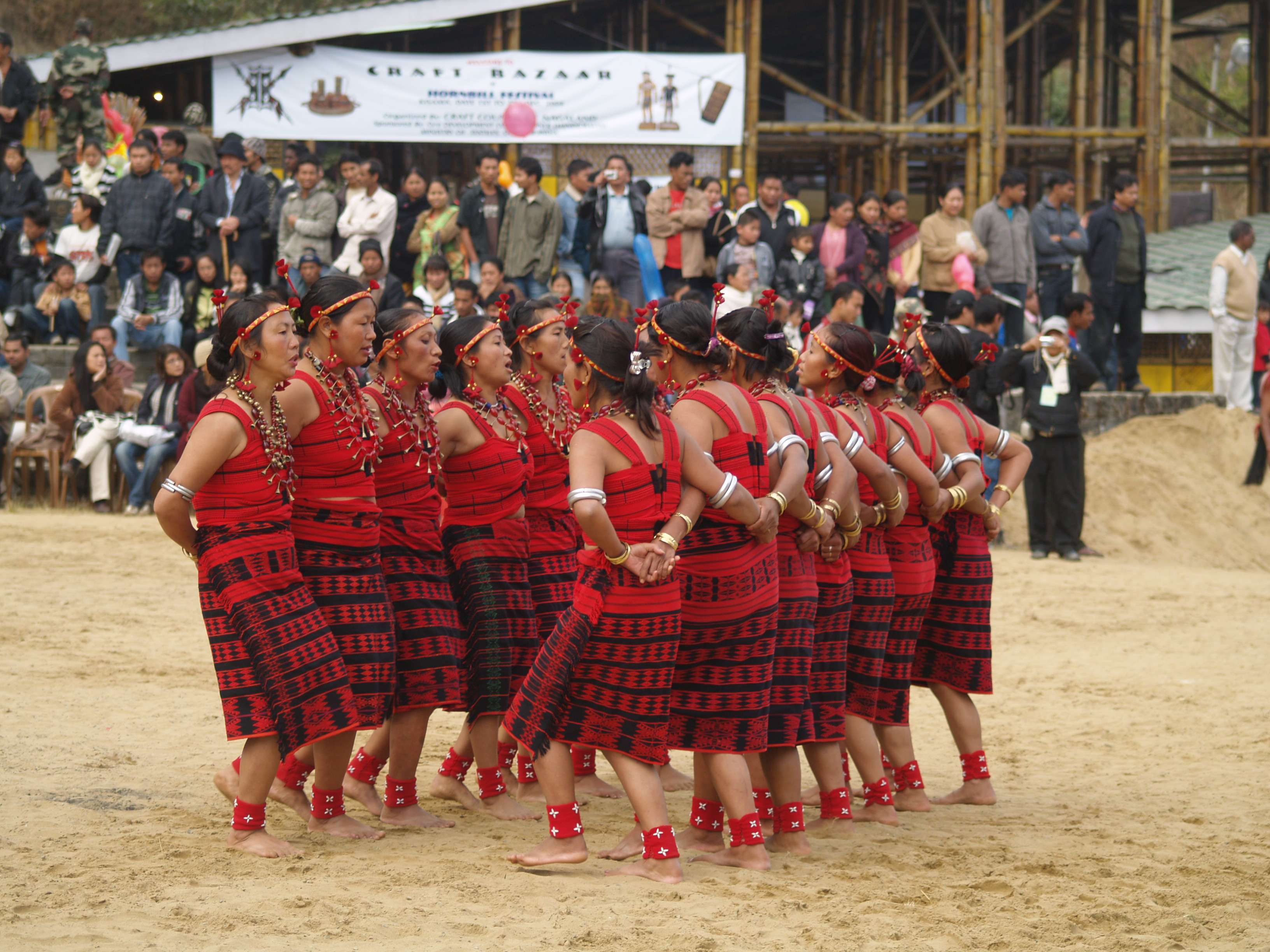
The hilly state is inhabited by 16 major tribes along with a few other sub-tribes. The sixteen tribes that dominate the region include Angami, Ao, Chang, Lotha, Konyak, Sumi, Chakhesang, Dimasa Kachari, Khiamniungan, Phom, Sangtam, Rengma, Kuki, Yimchunger, Zeme-Liangmai (Zeliang) and Pochury. Each of the 16 tribes is distinct in terms of dialect, attire and customs.
Apart from natural beauty, the state is also known for its diverse wildlife. Moreover, the incredible cultures, folklore and history of Nagaland make it among the richest in India in terms of aesthetic diversity.
Although the state observes travellers throughout the year owing to its round-the-year salubrious climate, the time from October to May is considered ideal to come here. The traditionally carved Khonoma Gate, about 20 km from Kohima, reflects the bravery of the local tribesmen. A good place to learn about the history and traditions of the state is the Nagaland State Museum in Kohima, which houses a fine collection of pillars, jewellery, gateposts and statues.
Scaling Japfu Peak, and camping and trekking are popular activities in the Dzukou Valley. An ideal point for birding, Changtongya town is noted for migratory falcons that come to the region all the way from Mongolia and Germany. Moreover, Shilloi Lake and the village of Meluri are perfect spots to revel in the beauty of nature.
The three sanctuaries in the state, namely Pulie Badze Sanctuary, Fakim Wildlife Sanctuary and Itanki Wildlife Sanctuary, are home to numerous regional species. Tigers, slender loris, bison, hoolock gibbons, Himalayan bears, panthers and wild boars are some of the animals that live in these sanctuaries. Additionally, birds like tragopan, Indian hornbills, grey peacock-pheasants, jungle fowl, white-naped yuhinas and doves can be found here in their natural environment.
Made of bamboo or cane, furniture and decor items like sculptures, wall panels and lampshades are the speciality of the state. These can be purchased from a number of curio shops, located in various cities and towns, especially in Kohima. Nagas, the natives of Nagaland, are known for their skills in arts and crafts like weaving, basketry, woodcarving, pottery and metalwork. Hand-woven shawls, bags and woven jackets are some of their most famous products.
The annual Hornbill Festival takes place at the Naga heritage village of Kisama in the month of December. During the celebrations, traditional dance, song, wrestling and archery performances are given by different tribes. Rice is the staple food of the Nagas, and vegetables are mostly cooked with some meat. The major constituents of Naga specialities are meats and fish that are usually fermented, dried or smoked. Herbs and chillies are mostly used to give flavours to a dish, whereas spices are usually avoided. Crab Chilli Sauce, Pork in Dry Bamboo Shoots, Dried Pork and Beans Mix are some famous dishes of the state.
History
Although the information on the early history of Nagaland is debated, some anthropologists believe Nagas to have descended from the Mongoloid race. However, there are no official records for the same. A few historical records suggest that the Nagas inhabited the region prior to the arrival of the Ahoms in AD 1228.
Before the advent of colonialism in South Asia, Burma (the present day Myanmar) carried out numerous raids and persecutions on the Naga tribes and other inhabitants of Northeast India. Myanmar captured Assam in 1816 and maintained its rule over the region from 1819 to 1826 till the arrival of the British. Thereafter, the British continued ruling the region and captured the whole of the Naga region, excluding the Tuensang area. The British administration is credited with bringing the much-needed end to war and inter-regional conflict in the area.
After the Indian Independence in 1947, Nagaland continued to be a part of the Indian state of Assam. Later, the region witnessed intense revolts by radicals and Naga tribes, asking for separation from India, but the Indian Army eventually succeeded in suppressing the riots in 1955. Further, the then district of Assam, Naga Hills, and the Tuensang area were clubbed to form a single unit under the Indian administration. It was later decided to make Nagaland a separate Indian state at the 1960 Naga People's Convention. Nagaland finally achieved complete statehood in the year 1963, which marks an important milestone in the history of the state.
Geography
The state is spread over an area of around 16579 sq km and is mostly hilly. The Naga Hills rise to a height of about 1800 metres above sea level. The state's highest peak, Mount Saramati lies at an altitude of 3841 metres, and is the merger point of the Naga Hills and Patkai Hills. The Patkai Hills form the natural border between Nagaland and Myanmar.
Doyang, Dhansiri, Jhanji, and Dikhu, the four major rivers that pass through Nagaland are the tributaries of the Brahmaputra River. Almost 20 per cent of the state is covered by wooded forests that are known for their diverse flora and fauna. Additionally, subtropical forests and tropical evergreen forests are in abundance within the state.
Weather
Round the year, the hilly state experiences a pleasant weather, which is responsible for the exceptional health and well-being of the local people. The major factors that govern Nagaland’s climate are the direction of the wind, distance from the sea and altitude.
The state experiences a monsoon climate with high humidity. It mostly rains between May and September with an annual average varying between 1800 and 2500 mm. Summer, the shortest season, lasts for only a few months, and the temperature during the same varies from 16 to 31 degree Celsius.
Usually, the temperature during winters does not drop below 4 degree Celsius. However, frost often occurs in the areas at relatively higher altitudes. Northwest winds also lash the region during the winter months of February and March.
How to reach
Dimapur Airport is the only airport in the state that is about 6 km from the city of Dimapur and nearly 70 km from Kohima. The airport has scheduled flight services to and from Kolkata and Delhi, and Dibrugarh in Assam.
An extensive network of national and state highways connects important towns and cities within the state as well as Nagaland with neighbouring states. Kohima is linked to Shillong and Guwahati, two significant cities in Northeast India, by highways. Similarly, Kohima and Dimapur are conveniently connected to each other by roads. The state-owned transport department runs buses from Dimapur to Kohima. Moreover, luxury and standard buses operated by private service providers also ply between Guwahati and Dimapur.
The railways are not much popular as the rail network within Nagaland is minimal due to the hilly terrain in its most part. Dimapur has the sole railway station that has regular train services to and from Guwahati, which is the gateway to Northeast India. In fact, Guwahati is well connected to most of the major towns and cities in India by a vast network of rail tracks.


 Share Via


