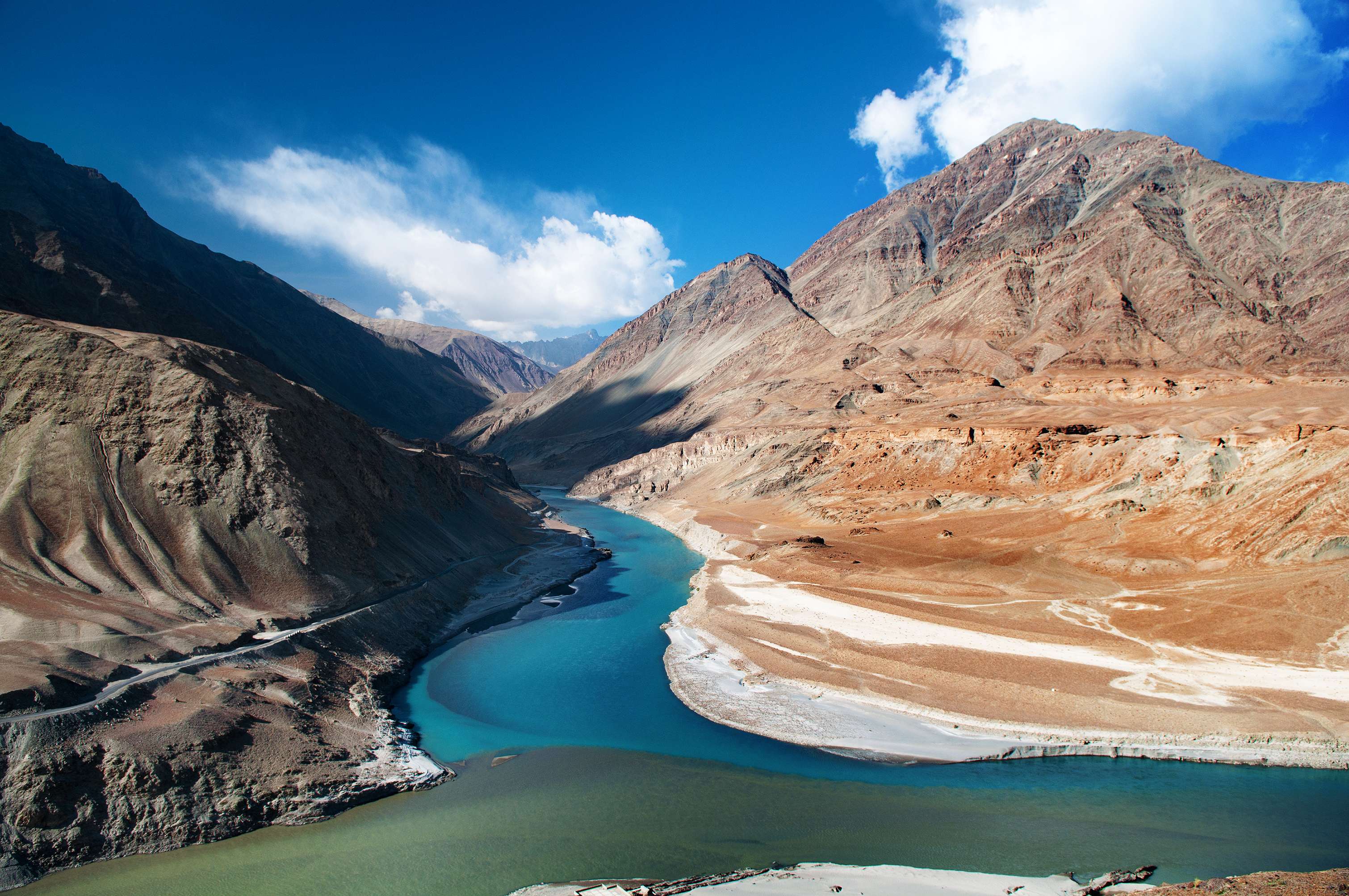
Ladakh is a high-altitude cold desert-plateau, located in the northernmost part of the state of Jammu and Kashmir. Geographically, the region also includes Lahaul and Spiti, Baltistan and Aksai Chin. One of the largest geographical regions in the country in terms of area, it is also one of the most sparsely populated. A population of only about 260000 against a land area of around 86904 sq km is a direct result of its remoteness, mostly barren land and extreme climatic conditions.
Most of the inhabitants in Leh, one of the two districts in Ladakh, are of Tibetan, Monpa and Dard descent. The most widely spoken language here is Ladakhi, which is derived from Tibetan languages. For ages, agriculture and animal husbandry have been the primary occupation of the Ladakhis. They grow wheat and barley that can be easily cultivated at high altitudes. Sheep, goats and yak are the common livestock, kept by these people. They use them to obtain milk, butter, meat and wool that they consume themselves and also sell in the market. Tourism is another industry that has been driving the region’s economy. Stok, Hemis, Lamayuru and Alchi monasteries, Gurdwara Pathar Sahib, and adventure sports are some important attractions here.
The local culture is strongly influenced by Tibetan or Himalayan Buddhism, which is evident in their music and dance forms. Their songs involve the chanting of religious verses in either Tibetan or Sanskrit language. A particular chant, known as Yang, does not feature metric rhyme and is accompanied by drums. Cham or mask dances are mostly performed by lamas during festivals in the courtyards of monasteries. The masks are used to symbolise guardian deities of Vajrayana Buddhism, both wrathful and benevolent. Such dances either depict several incidents from the life of the revered deity, Padmasambhava, or a fight between evil and good.
Ladakhi cuisine is directly influenced from that of Tibet due to the similarity of the two regions and the produce available here. Barley is the most important grain for the Ladakhis that they eat with vegetables and meat. Gurgur Cha or butter tea is an iconic beverage of Ladakh. The Ladakhi people have participated in archery contests for centuries. Another popular sport here is polo due to the abundance of horses in the region. Nowadays, a local rendition of ice hockey has become popular in the winter months, when most of the regional streams and lakes are frozen.
Apart from historical, topographical and cultural value, Ladakh also has a high biological significance. The most significant mammal of the region is the snow leopard, which feeds on bharals, ibexes, Tibetan antelopes and Tibetan wild asses. Other prominent regional mammals are brown bears, wolves, sand foxes, musk deer, lynxes and gazelles. Even more significant than the mammalian diversity is the avian species found here that number 225. Black-necked cranes, brown-headed gulls, bar-headed geese, doves and pigeons, long-eared owls and Eurasian eagle owls are some important birds. Among the raptors here are bearded vultures or lammergeiers, cinereous vultures, Himalayan vultures and golden eagles.
History
The earliest records of human inhabitation in the region are rock carvings that have been dated by historians to the Neolithic times. As per the accounts of Herodotus, Megasthenes and Ptolemy, the first few inhabitants of Ladakh were the Dards and Mons. A Kharosthi inscription, discovered near the village of Khaltse, sheds light on the fact that Ladakh was a part of the Kushan Empire in 1st century AD. Buddhism first came here in the 2nd century. The 7th and 8th centuries were turbulent times as regular wars were fought between the Chinese and Tibetans, as both wanted control over Ladakh.
In the 8th century, the Arabs too joined these wars, but soon, the then ruler of Kashmir conquered most of the Ladakh. The conquest of Kashgar, a Chinese city, by the Arabs in the said century put a brief end to the Tibeto-Chinese wars. After the Tibetan empire disintegrated, a royal from there took over Ladakh, and this resulted in the second spreading of Buddhism in the region. Five hundred years later, it again faced raids from Muslim rulers that continued for the next 300 years. In the 16th century, Bhagan defeated Tibet and established the Namgyal dynasty in Ladakh.
The Balti invasion of 1594 again established the Muslim rule here, and Islam again started to be preached. Under the command of the 5th Dalai Lama, a coalition of Tibetan and Mongol troops invaded Ladakh. The Ladakhis were reinforced by the Mughals, who also wanted to wield their influence on it. The Sikhs took control of Ladakh in 1834 and the Dogras in 1842. They remained in power till 1947 when the monarch acceded to India. The wars of 1947, 1965 and 1971 again brought massacre and bloodshed to the region. In 1979, the districts of Kargil and Leh were formed on the basis of the religions prominent there. Five years later, India sent troops to the Siachen Glacier and conquered it in its entirety.
Following riots between the Muslims and Buddhists in 1989, the Ladakh Autonomous Hill Development Council was formed to hold elections in the two districts. The last period of military activities in the region was the Kargil War of 1999; since then, Ladakh has enjoyed peace.
Geography
Ladakh is a rugged land with an average elevation of 10000 feet above sea level. It is marked in the south by the Himalayas and in the north by the Karakoram Range. Between these, are two more mountain ranges: Zanskar in the south and Ladakh in the north. To the southwest, the altitude of the Ladakhi Himalayas ranges between 16000 and 18000 feet, and in the northeast, it is as much as 23400 feet on the Nun-Kun massif. However, Saser Kangri with an altitude of around 25000 feet in the Karakoram Ranges is the highest point in the Ladakh plateau.
Most of the important regional rivers like the Nubra and Shyok rise in the Karakoram Mountains, whereas the Zanskar River has its origin in the Himalayas. They, directly or after joining other rivers, eventually flow into the Indus River.
Through the southernmost part of Ladakh, flow the Zanskar and Suru Rivers that create a trough between the Himalayas and Zanskar Ranges. Immediately to the north, lies the Suru Valley, the maximum elevation of which is around 14000 feet. Beyond the Suru Valley, is the valley of Zanskar, which also contains two minor rivers, the Stod and Lungnak. Further to the north, flows the Indus River, and beyond that the Nubra, which originates from the Siachen Glacier.
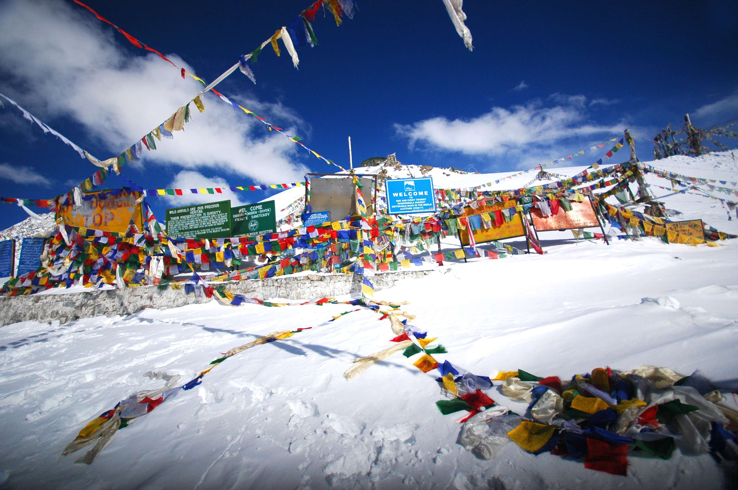
Apart from these rivers, Ladakh also has a number of glacial lakes as water resources, most of which are located above 14000 feet altitude. Three of the most famous such lakes are Tso Moriri, Tso Kar, and Pangong Tso, which also stretches into Aksai Chin – one of the main disputed border areas between India and China. One more characteristic feature of Ladakh is its high-altitude mountain passes that have been important for cross-border trade. Khardung La, Zoji La, Pensi La, Tanglang La, Namika La, Fotu La, Lachulung La and Chang La are notable.
Weather
The plateau of Ladakh is located in the rain shadow of the Great Himalayan Ranges. As a result, by the time the monsoon winds reach here, they are depleted of all moisture. Hence, most of the Ladakh is subject to cold desert climate (Köppen climate classification). The places at higher elevations, such as those in the mountains, have an Arctic climate. Here, snow is a perennial phenomenon, and the temperature never rises beyond the freezing point; elsewhere, the change in weather is significantly apparent.
In Leh, the administrative headquarter and largest city in the region, the maximum summer temperature can be as high as 35 degree Celsius while the minimum hovers around 10 degree Celsius. From May to October, the region receives precipitation in the form of rain, though scanty. From October itself, the temperature starts decreasing, and by the time winters arrive in full force, it goes to as low as -20 degree C. During this time, the maximum temperature seldom exceeds the 10 degree C mark. The season is characterised by extremely heavy snowfall, which shuts most of the national and state highways.
In Dras, which is among the coldest permanently inhabited places on earth, the minimum winter temperature often drops to -40 degree Celsius.
How to reach
Ladakh can easily be reached from around the country by air and road.
Road Connectivity: There are two main highways that connect the rest of the country to Ladakh. One is National Highway 1D, also known as Srinagar-Leh Highway, which links the capital of Jammu and Kashmir, Srinagar, to the city of Leh. It goes via the towns of Kargil and Dras, Zoji La, Namika La and Fotu La, and the Ladakhi villages of Lamayuru and Alchi.
The other option is the famed Leh-Manali Highway, which links Leh to Manali in Himachal Pradesh. It meanders through the mountains and goes past Keylong, the headquarters of the Lahaul and Spiti district of Himachal Pradesh, and the villages of Hemis, Thiksey and Shey in Ladakh. The mountain passes on the route are Rohtang Pass, Baralacha La, Lachulung La and Taglang La.
Air Connectivity: Ladakh is primarily served by the Kushok Bakula Rinpoche Airport in Leh. It has regular flights from major Indian cities like Delhi, Jammu, Srinagar and Mumbai. As an alternative, flights can also be taken to the Srinagar airport, and the rest of the journey can be completed by road.
Government-run and private buses and taxis are available from Manali and Srinagar to reach Leh.
Getting Around
To travel within Ladakh, taxis and buses can be hired from Leh. Trekking is another option to reach places within short and relatively longer distances.


 Share Via


_1438757239_EHwZ37.jpg)


